
The National Park region
Engadin
Discover picturesque Engadine villages where Romansh culture shapes everyday life. Enjoy hiking and mountain biking near the Swiss National Park and relax at the Bogn Engiadina mineral baths. Surrounded by fresh mountain air, unspoiled nature, and bubbling mineral springs, you’ll create unforgettable vacation memories with family and friends.
Our region is also the first vacation region in Switzerland to be awarded the Swisstainable Destination III - leading sustainability label. We are committed to sustainable tourism that promotes the preservation of nature and the respectful use of its resources, while at the same time fulfilling its social and economic responsibilities. Experience summer activities that refresh body and soul with tranquillity, culture and sporting adventure.
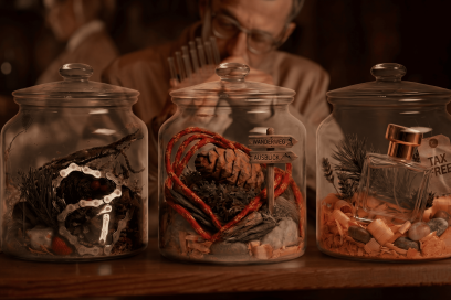
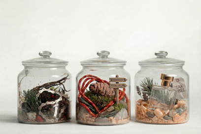
Too intense for a single glass.
Ready for the real thing?
We are looking for participants for our summer field study in the Lower Engadine. High-alpine wilderness, mineral water, Romansh culture—summer vacation you won’t soon forget.


